By the time I publish this, I will have just finished presenting at the 40th annual North American Cartographic Information Society (NACIS) conference. NACIS is a large community of map enthusiasts who meet once a year to share and learn about cartography projects. This year’s conference is being held virtually due to the current pandemic crisis.
The ultimate goal of my presentation was to share the latest updates to Esri’s mapping extension for Adobe Illustrator called ArcGIS Maps for Adobe Creative Cloud (Maps for Adobe). In a few short days, I’ll be writing about the steps I used to make those maps at this link. But for now, I wanted to share the maps I made for the NACIS presentation – as promised to the nice folks who came to my talk.
But wait there’s more!
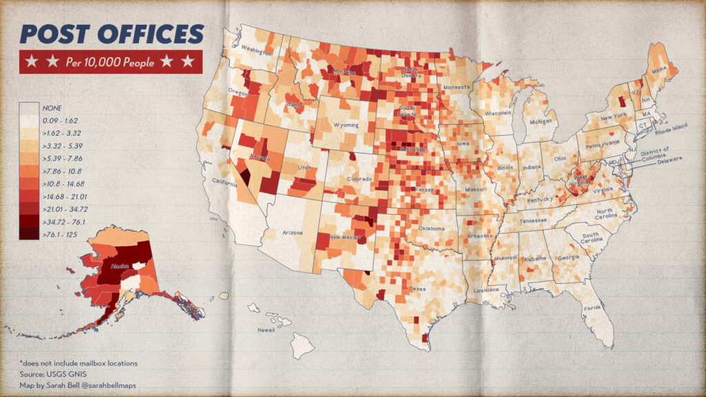
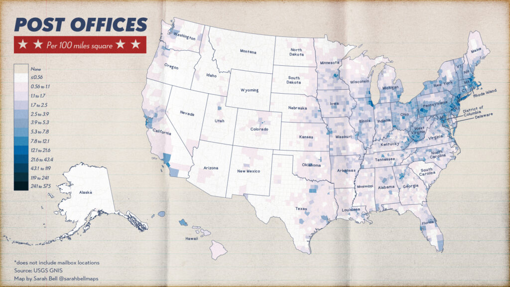
I am going to edit this post later this evening, and offer a little statistical analysis on rural counties and US Post offices. As the maps show, post offices increase per capita the less densely populated a county is. Having lived in very (very, very) rural places in the US, I think that is pretty cool. The postal service has always been a celebrated part of the American landscape, and has become increasingly so during this current pandemic. The Postal Service is a lifeline for rural areas (as National Geographic outlined), and the pandemic has stressed this link for many rural Americans.
So for now, this is just a quick post of the maps I made from the steps in my presentation, but I’ll share when I have the statistical analysis complete.
Thank you!
Sarah Bell
P.S. The state labels in each of these maps use the BellTopo Sans font, free to download here.
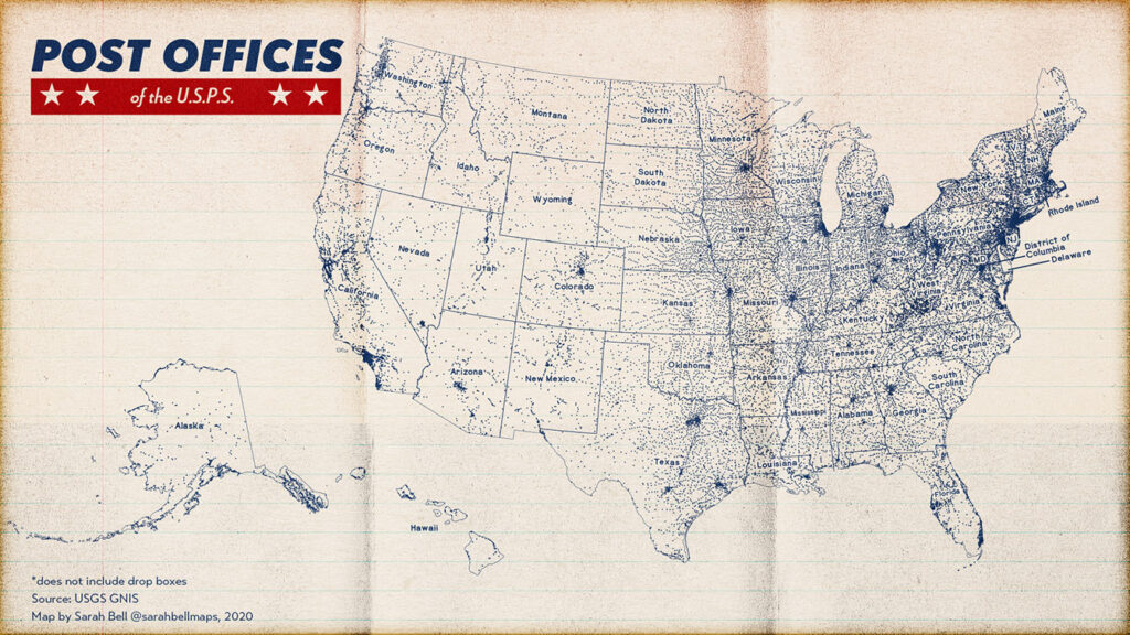
This first map shows the more-than 32,000 USPS post office locations in the 50 US states. It is important to note that there are post offices in Puerto Rico, Guam, the U.S. Virgin Islands, American Samoa, and the N. Mariana Islands as well.
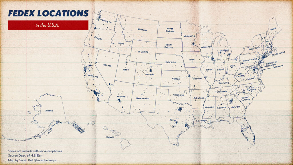
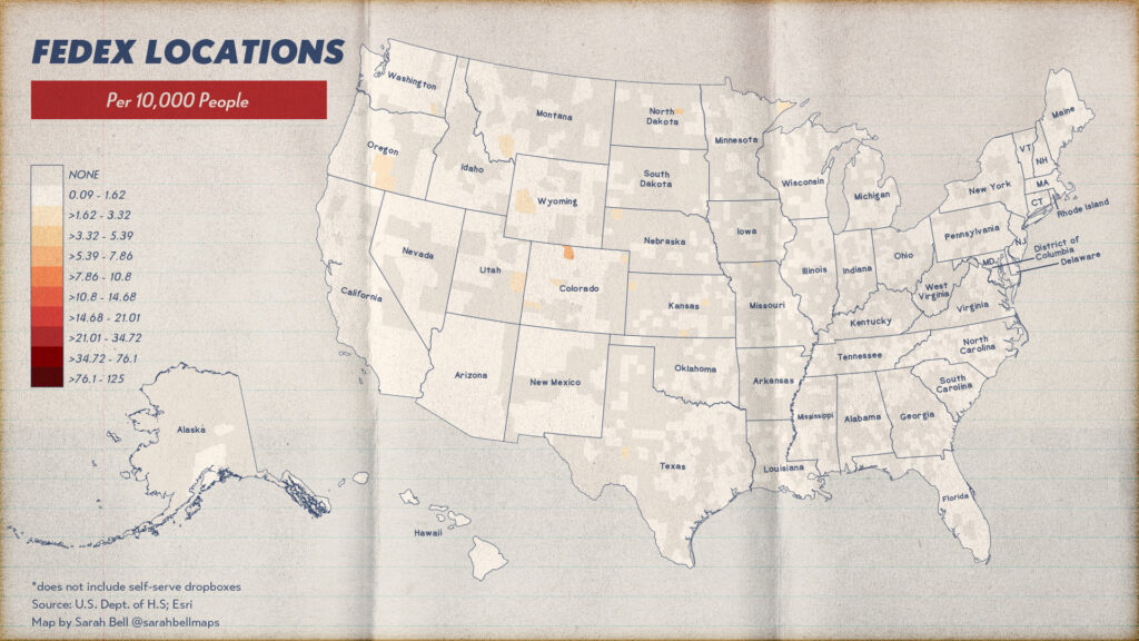
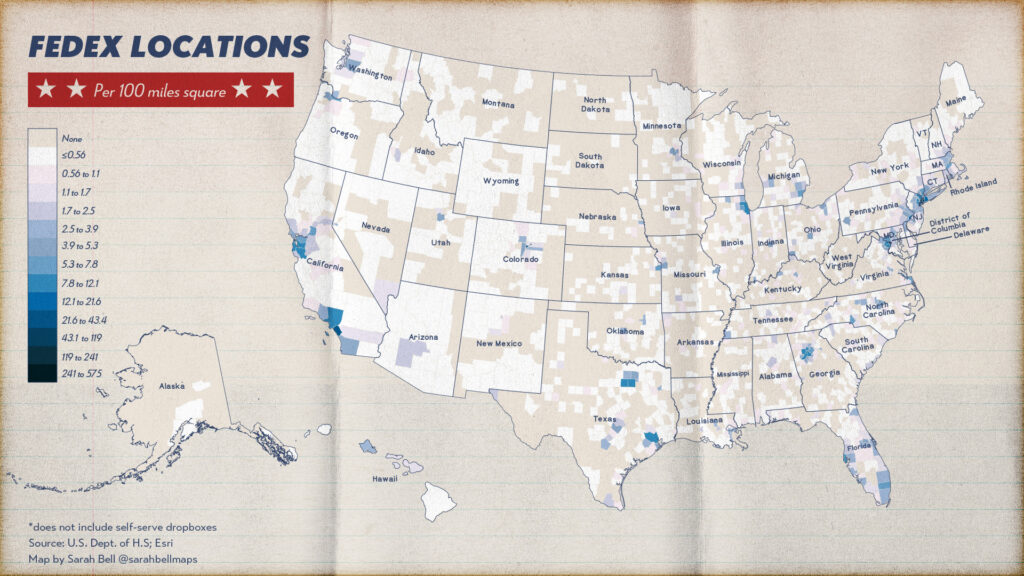
When I started this mapping project, I was curious to see how the USPS locations differ from the FedEx. I found this dataset of FedEx locations on the Department of Homeland Security’s open data page. Before making this map, I removed all of the FedEx “self serve boxes” from the dataset because I wanted to initially have parity between the Post Office and FedEx locations. The Post Office dataset did not have their drop boxes. But I quickly learned that there is a complex difference between the Post Office and FedEx. I still include the maps, but more research needs to be done before an adequate comparison can be made. The remaining points in the FedEx dataset includes what FedEx Calls “Authorized Shipping Centers” and “FedEx Staffed” locations.