Skip to content
  • Home
  • About
  • Portfolio
  • Contact
  • Blog

Sarah Bell Maps

Experienced creative geospatial science & cartography

  • Home
  • About
  • Portfolio
  • Contact
  • Blog
  • Home
  • About
  • Portfolio
  • Contact
  • Blog

Tag: tutorial

New Adobe Illustrator video series how to make illustrator symbol libraries

Adobe Illustrator Symbol-Making Tutorial Series

Nov 15, 2024Sarah BellAdobe Illustrator, After Effects, Cartography, Tutorials, youtubeadobe, illustrator, library, symbol, symbols, tutorial, video

Announcing a new Adobe Illustrator tutorial series, beginning with how to make symbols and symbols libraries.

Hand drawn Hillshade of mountain near Anchorage Alaska with Knik Glacier

Drawing Hillshade by Hand with Pencils. A tutorial (with time-lapse videos)

Jan 16, 2024Sarah BellCartography, drawing, graphic design, Tutorialsgraphite, hand drawn, hand drawn hillshade, hand-drawn, hillshade, pencil, shaded relief, tutorial

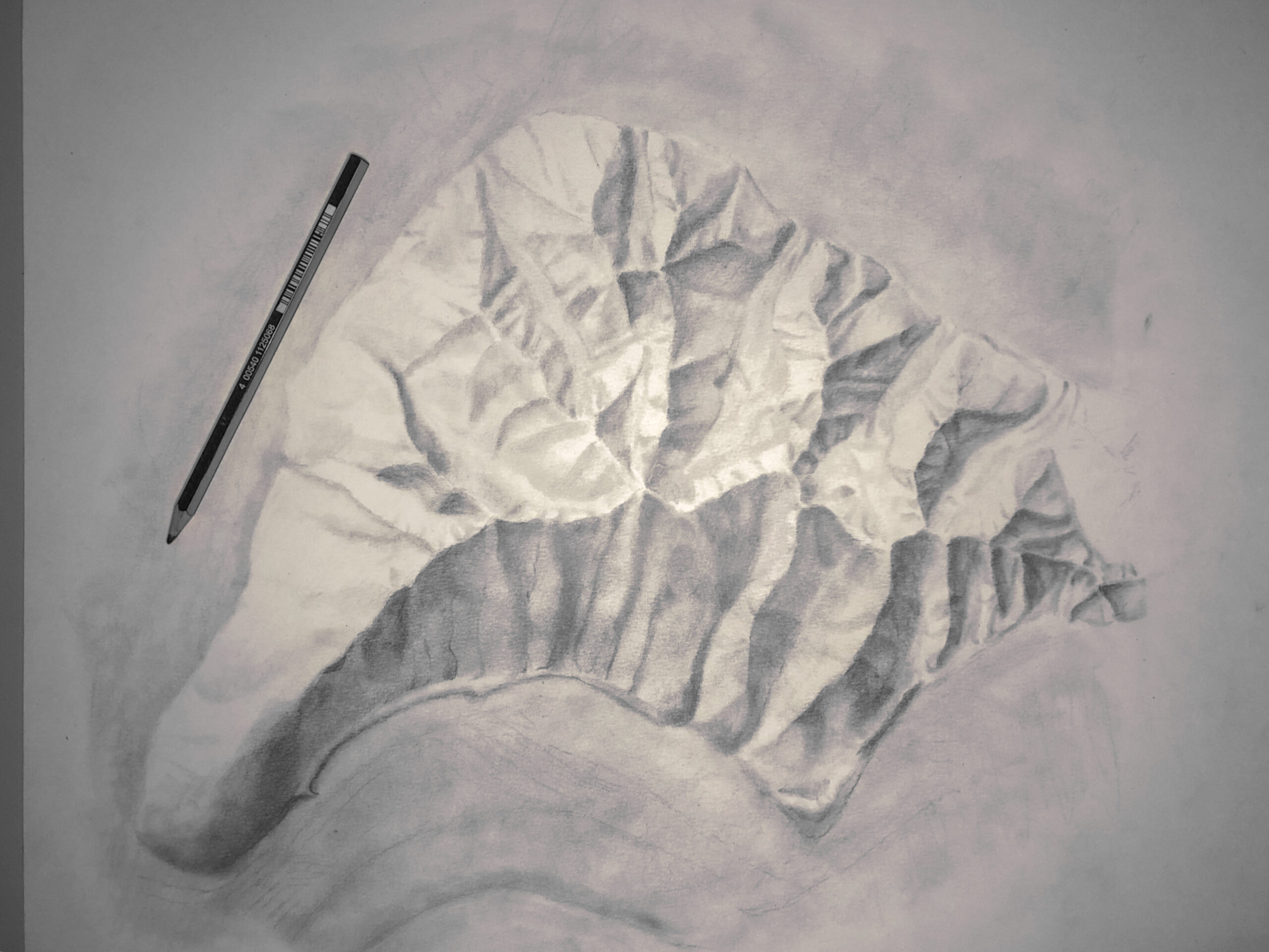
Learn how to hand draw beautiful shaded relief hillshades in this 6-step tutorial.

Red River Gorge small map

Adobe MAX 2019: Mapping

Nov 5, 2019Sarah BellUncategorizedadobe max, cartography, mapping, resources, tutorial

By the time you are reading this, my colleague John Nelson and I will have presented to a bunch of fantastic creatives at Adobe MAX 2019 about making maps as designers. Designers make gorgeous maps, because oftentimes they don’t confine themselves to super strict ideas of what a map should look like. Plus, well… they’re…

Read More

Developed by Shuttle Themes. Powered by WordPress.
  • Home
  • About
  • Portfolio
  • Contact
  • Blog
Go to mobile version