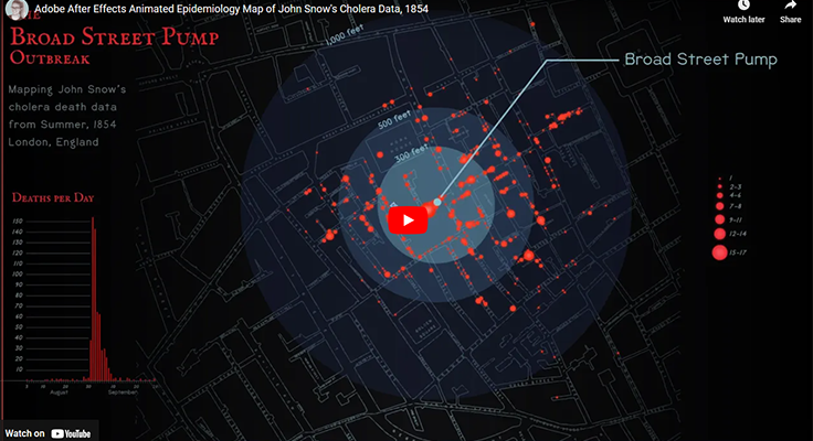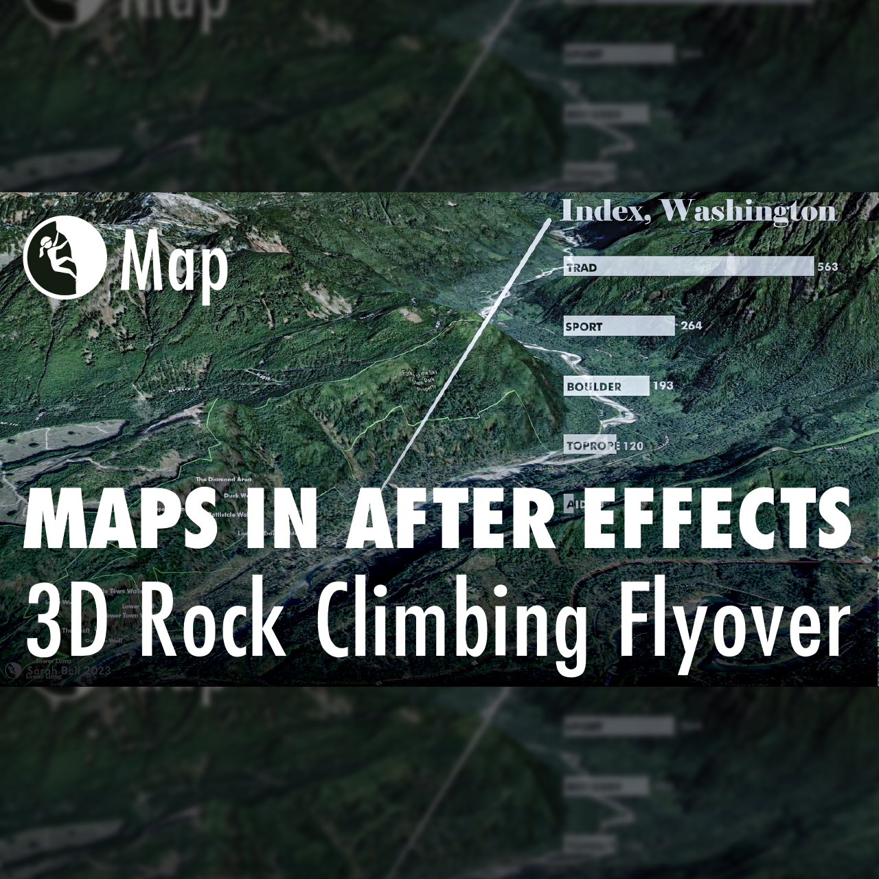
Animated Flyover Map in ArcGIS Pro and Adobe After Effects
Building maps often requires multiple software applications. In fact, I cannot recall a map that I’ve made in the last decade that did not include using at least two different applications. For this map, I created a flyover animation in ArcGIS Pro. I then imported the animation (mp4) into Adobe After Effects, where I added…